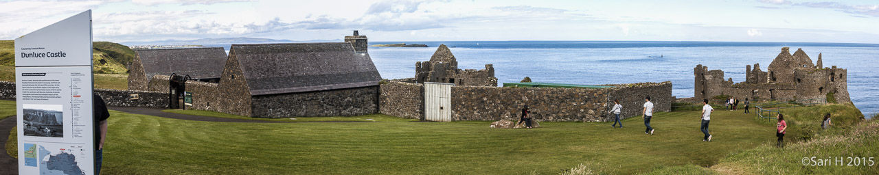
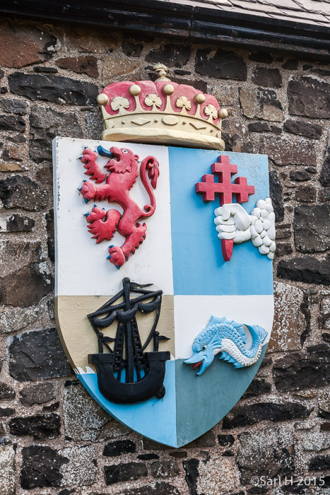
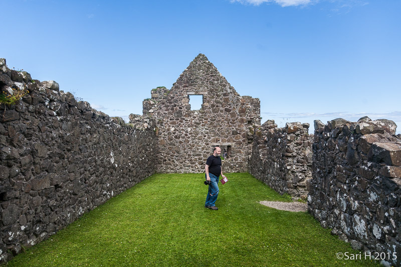
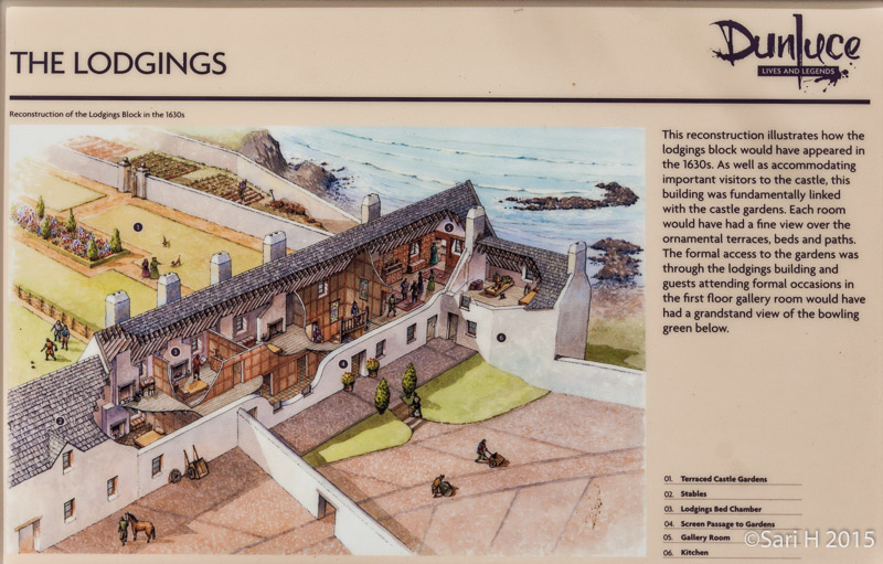
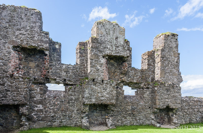
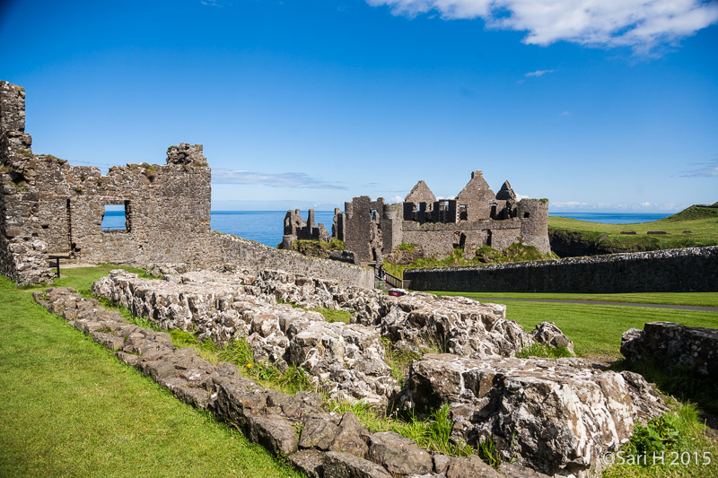
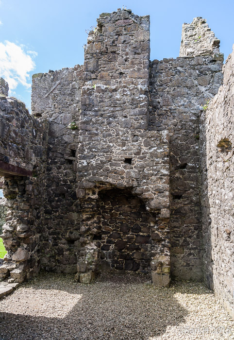
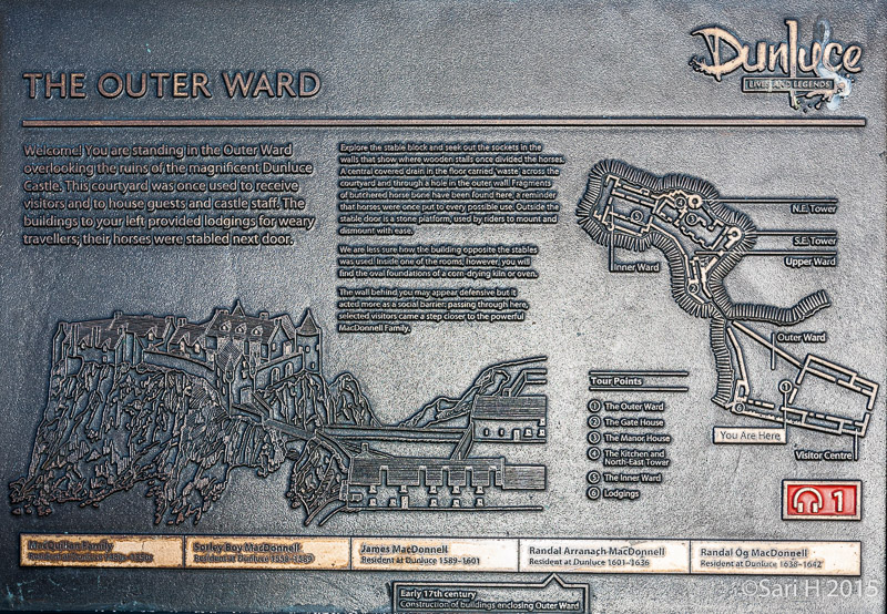
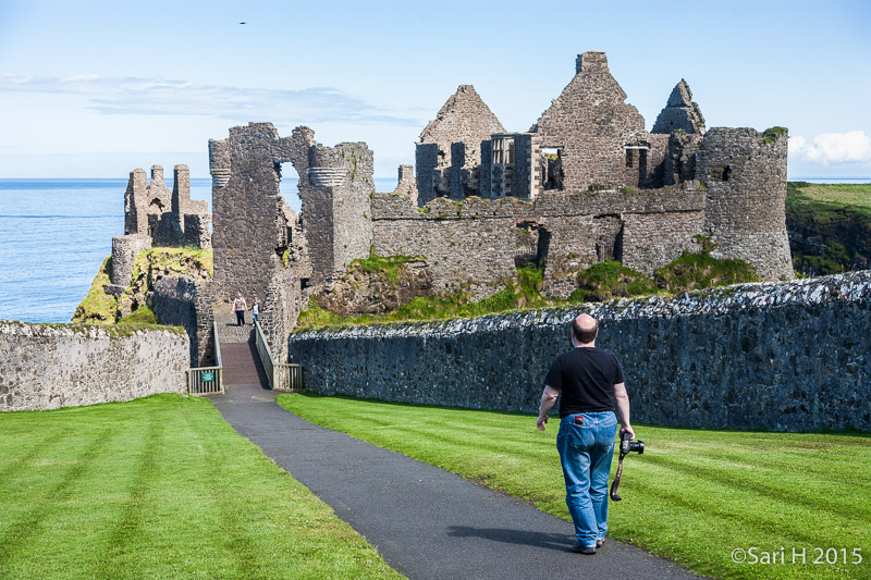
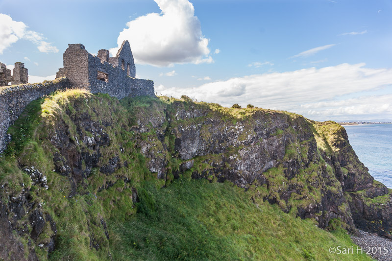
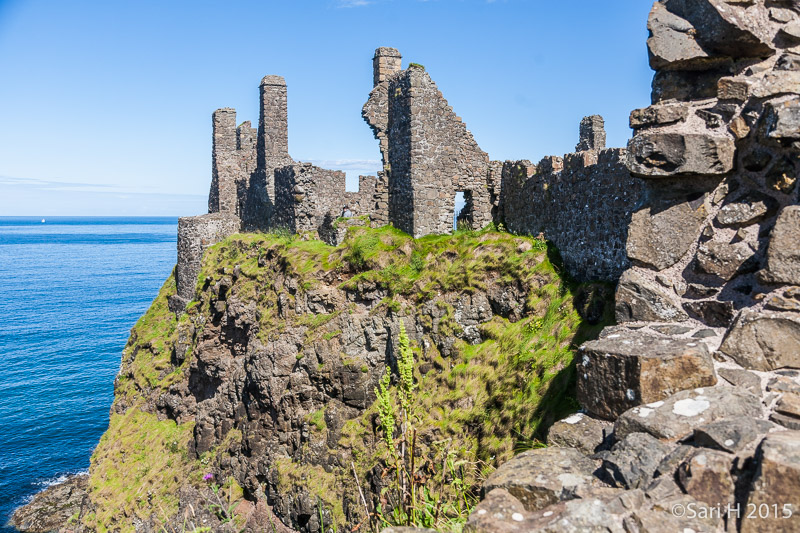
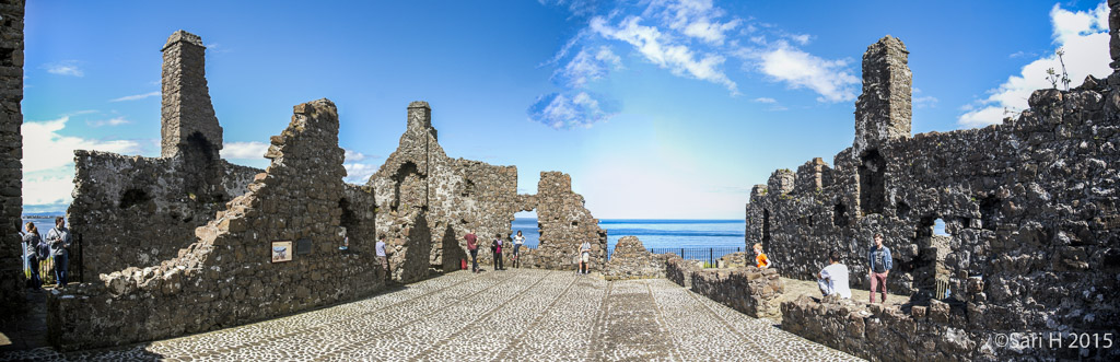
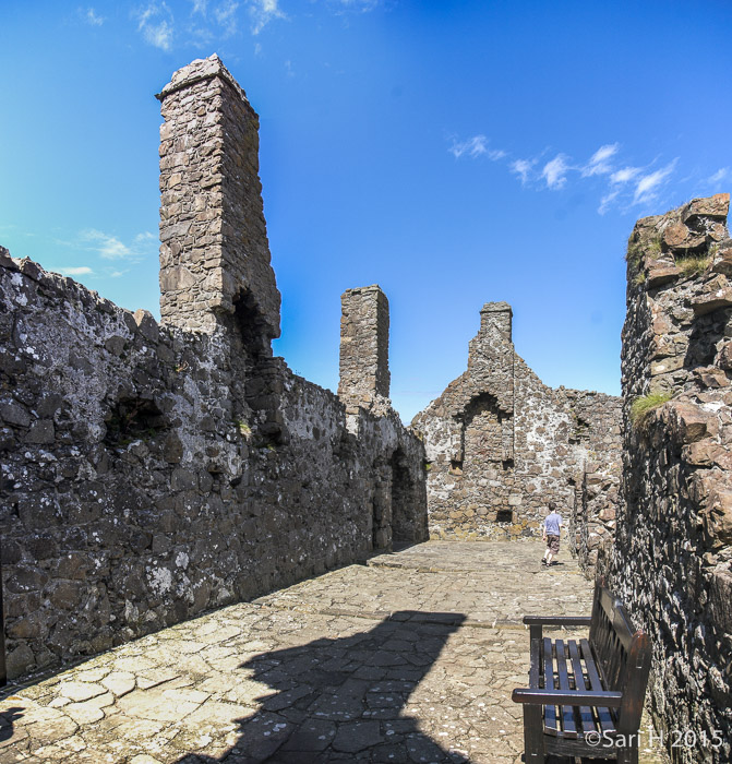
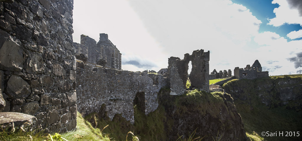
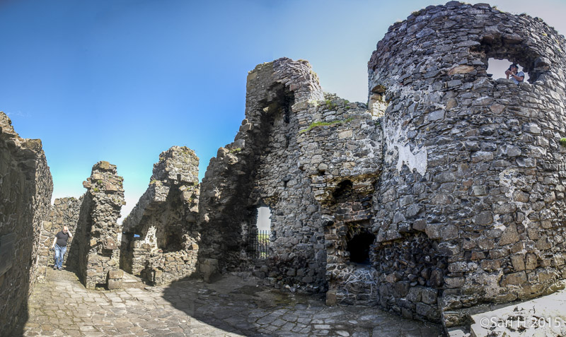
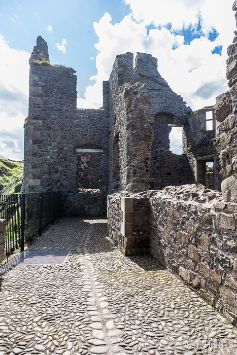
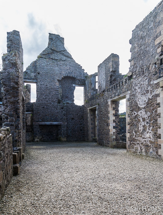
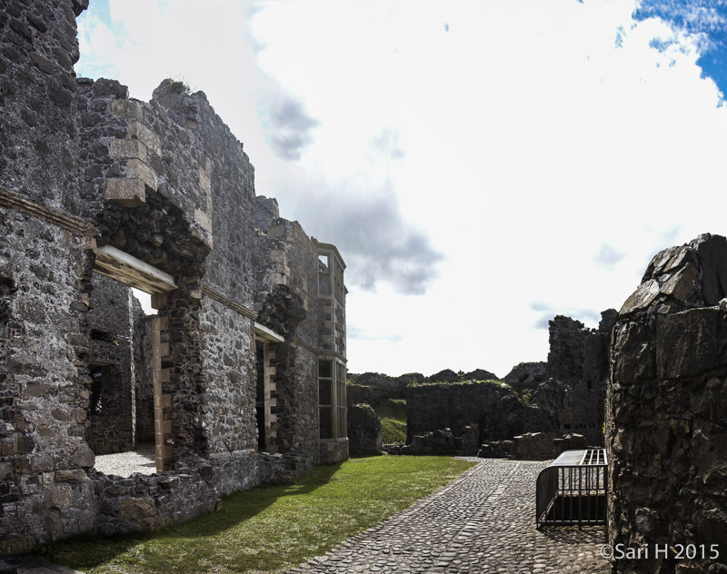
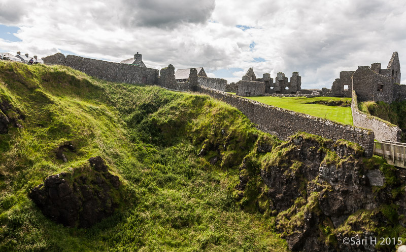
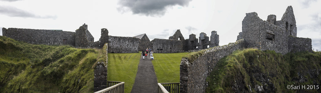
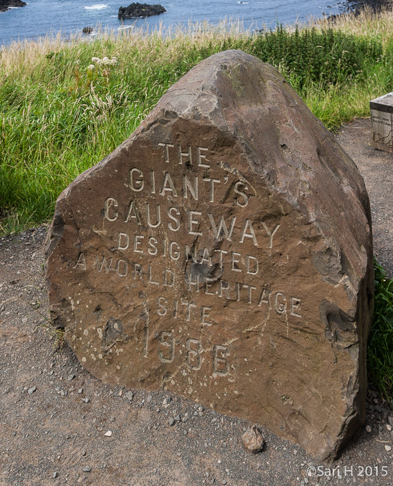
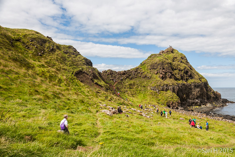
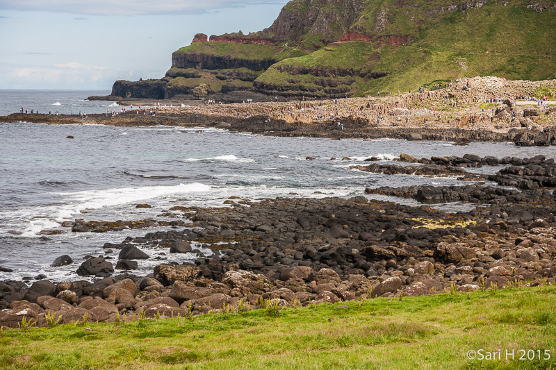
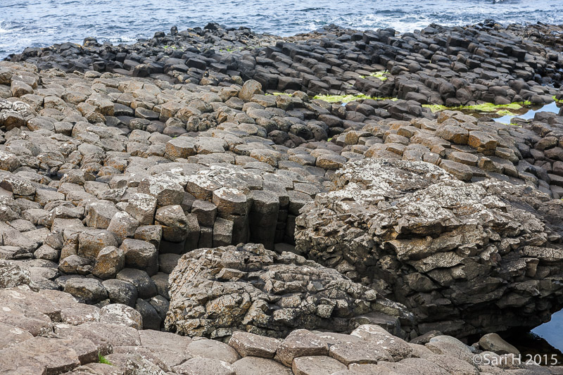
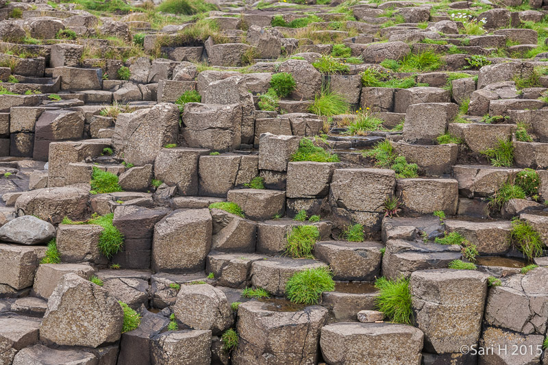
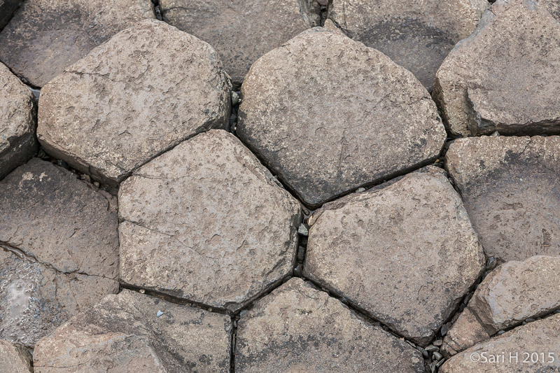
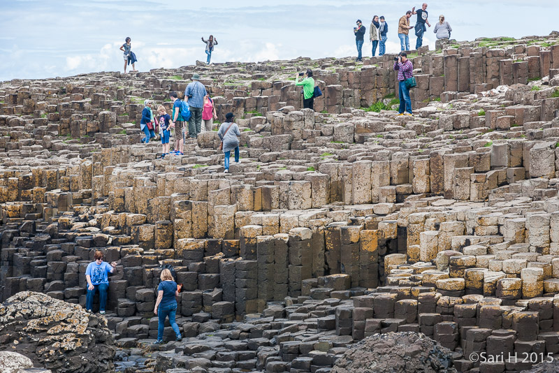
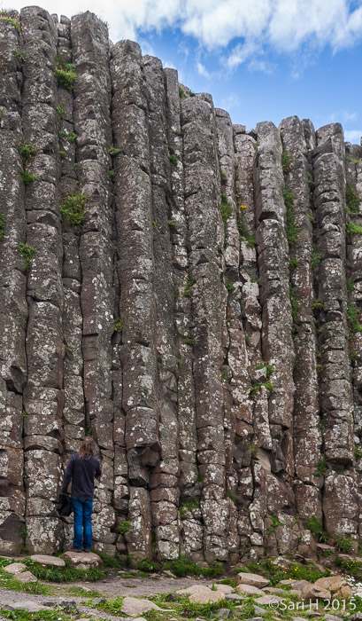
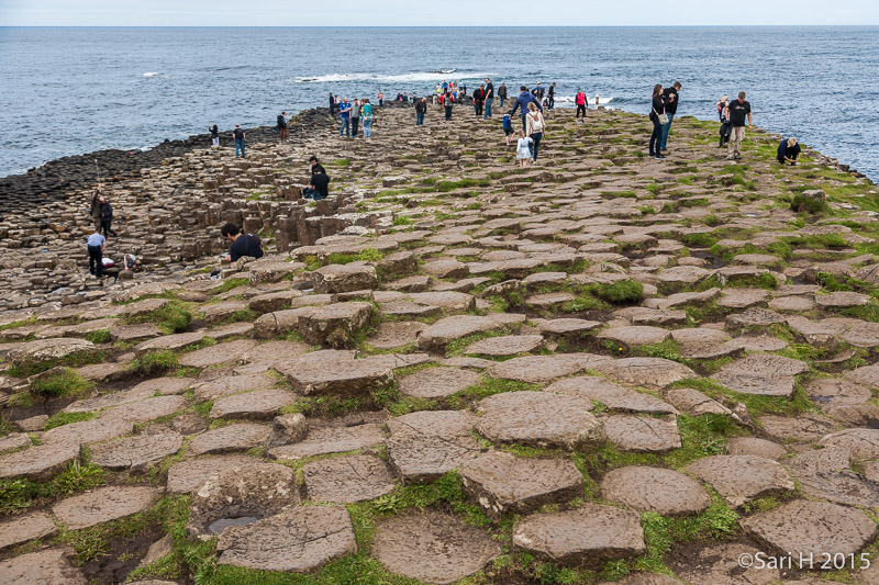
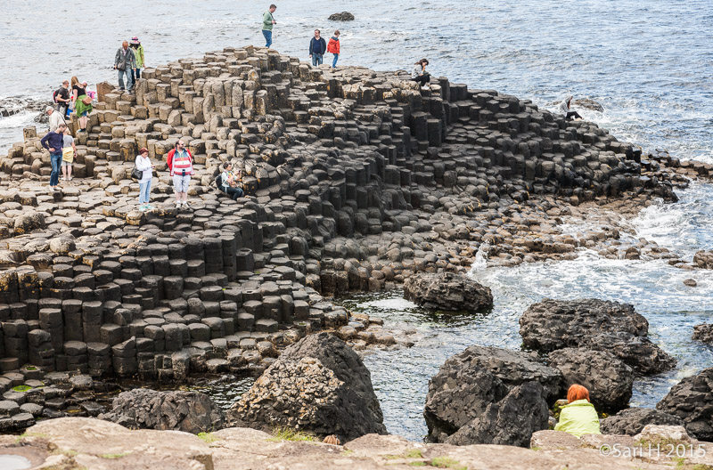
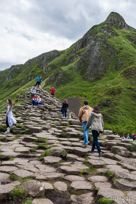
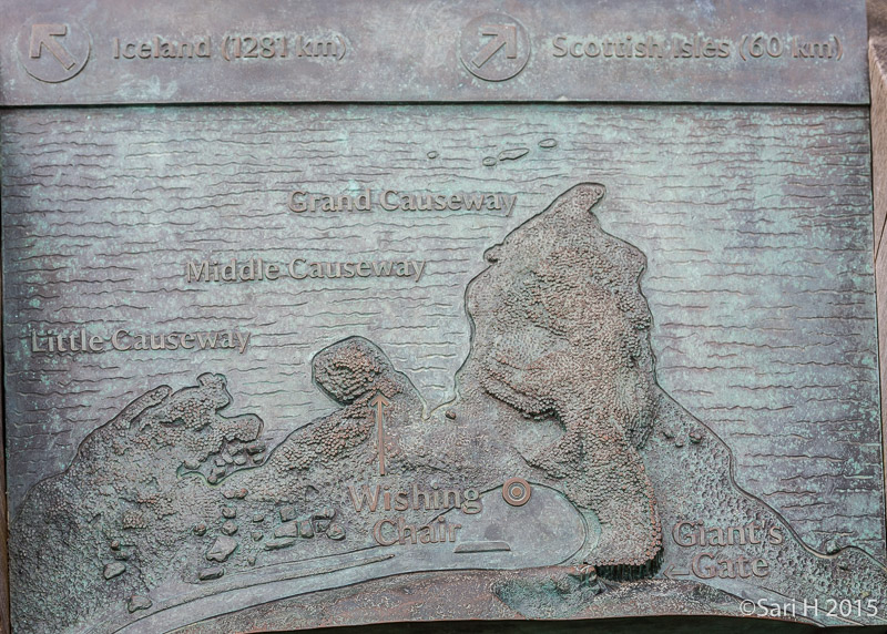
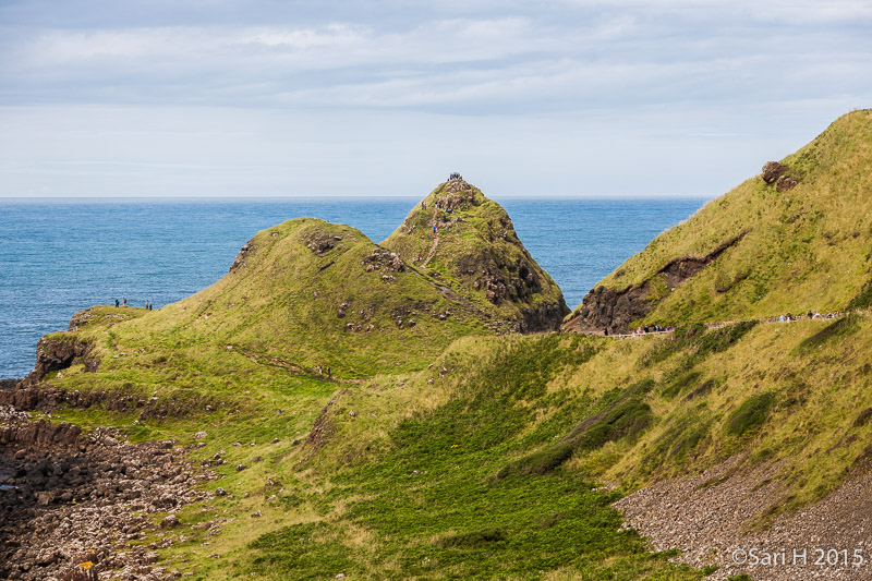
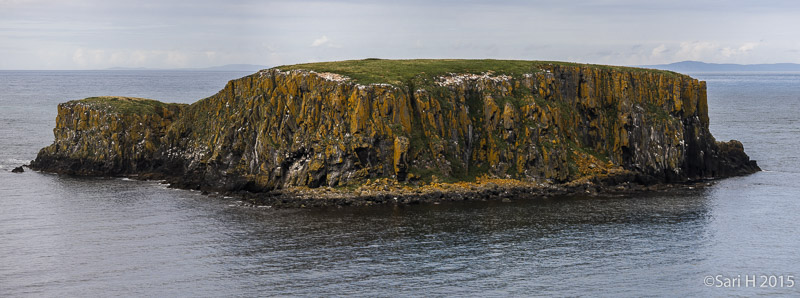
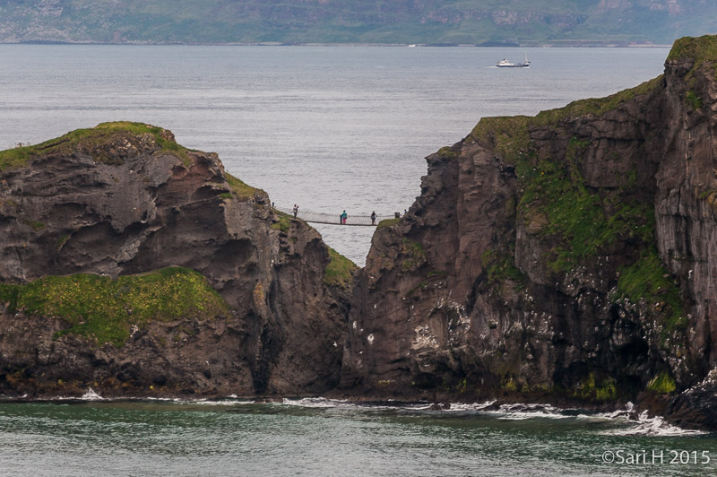
Dunluce, Giant's Causeway and Carrick-a-Rede

Pictures taken at Dunluce castle, Giant's Causeway and Carrick-a-Rede rope bridge on our Summer Holiday in Ireland 2015.
Dunluce Castle  Dunluce Castle (from Irish: Dún Libhse) is a now-ruined medieval castle in Northern Ireland. It is located on the edge of a basalt outcropping in County Antrim (between Portballintrae and Portrush), and is accessible via a bridge connecting it to the mainland. The castle is surrounded by extremely steep drops on either side, which may have been an important factor to the early Christians and Vikings who were drawn to this place where an early Irish fort once stood. In the 13th century Richard Óg de Burgh, 2nd Earl of Ulster, built the first castle at Dunluce. It is first documented in the hands of the McQuillan family in 1513. The earliest features of the castle are two large drum towers about 9 metres  in diameter on the eastern side, both relics of a stronghold built here by the McQuillans after they became lords of the Route. The McQuillans were the Lords of Route from the late 13th century until they were displaced by the MacDonalds after losing two major battles against them during the mid and late-16th century. : Dunlace, Ireland, Irlanti, Northern Ireland, Pohois-Irlanti, building, castle, historia, history, kesäloma, linna, matka, rakennus, summer holiday, travel Dunluce Castle  The coat of arms of McDonnell of Antrim, as displayed in their historic seat, Dunluce Castle. : Dunlace, Ireland, Irlanti, Northern Ireland, Pohois-Irlanti, building, castle, historia, history, kesäloma, linna, matka, rakennus, summer holiday, travel Dunluce Castle  Dunluce Castle (from Irish: Dún Libhse) is a now-ruined medieval castle in Northern Ireland. It is located on the edge of a basalt outcropping in County Antrim (between Portballintrae and Portrush), and is accessible via a bridge connecting it to the mainland. The castle is surrounded by extremely steep drops on either side, which may have been an important factor to the early Christians and Vikings who were drawn to this place where an early Irish fort once stood. In the 13th century Richard Óg de Burgh, 2nd Earl of Ulster, built the first castle at Dunluce. It is first documented in the hands of the McQuillan family in 1513. The earliest features of the castle are two large drum towers about 9 metres  in diameter on the eastern side, both relics of a stronghold built here by the McQuillans after they became lords of the Route. The McQuillans were the Lords of Route from the late 13th century until they were displaced by the MacDonalds after losing two major battles against them during the mid and late-16th century. : Dunlace, Ireland, Irlanti, Northern Ireland, Pohois-Irlanti, building, castle, historia, history, kesäloma, linna, matka, rakennus, summer holiday, travel Dunluce Castle  Dunluce Castle (from Irish: Dún Libhse) is a now-ruined medieval castle in Northern Ireland. It is located on the edge of a basalt outcropping in County Antrim (between Portballintrae and Portrush), and is accessible via a bridge connecting it to the mainland. The castle is surrounded by extremely steep drops on either side, which may have been an important factor to the early Christians and Vikings who were drawn to this place where an early Irish fort once stood. In the 13th century Richard Óg de Burgh, 2nd Earl of Ulster, built the first castle at Dunluce. It is first documented in the hands of the McQuillan family in 1513. The earliest features of the castle are two large drum towers about 9 metres  in diameter on the eastern side, both relics of a stronghold built here by the McQuillans after they became lords of the Route. The McQuillans were the Lords of Route from the late 13th century until they were displaced by the MacDonalds after losing two major battles against them during the mid and late-16th century. : Dunlace, Ireland, Irlanti, Northern Ireland, Pohois-Irlanti, building, castle, historia, history, kesäloma, linna, matka, rakennus, summer holiday, travel
Dunluce Castle  Dunluce Castle (from Irish: Dún Libhse) is a now-ruined medieval castle in Northern Ireland. It is located on the edge of a basalt outcropping in County Antrim (between Portballintrae and Portrush), and is accessible via a bridge connecting it to the mainland. The castle is surrounded by extremely steep drops on either side, which may have been an important factor to the early Christians and Vikings who were drawn to this place where an early Irish fort once stood. In the 13th century Richard Óg de Burgh, 2nd Earl of Ulster, built the first castle at Dunluce. It is first documented in the hands of the McQuillan family in 1513. The earliest features of the castle are two large drum towers about 9 metres  in diameter on the eastern side, both relics of a stronghold built here by the McQuillans after they became lords of the Route. The McQuillans were the Lords of Route from the late 13th century until they were displaced by the MacDonalds after losing two major battles against them during the mid and late-16th century. : Dunlace, Ireland, Irlanti, Northern Ireland, Pohois-Irlanti, building, castle, historia, history, kesäloma, linna, matka, rakennus, summer holiday, travel Dunluce Castle  Dunluce Castle (from Irish: Dún Libhse) is a now-ruined medieval castle in Northern Ireland. It is located on the edge of a basalt outcropping in County Antrim (between Portballintrae and Portrush), and is accessible via a bridge connecting it to the mainland. The castle is surrounded by extremely steep drops on either side, which may have been an important factor to the early Christians and Vikings who were drawn to this place where an early Irish fort once stood. In the 13th century Richard Óg de Burgh, 2nd Earl of Ulster, built the first castle at Dunluce. It is first documented in the hands of the McQuillan family in 1513. The earliest features of the castle are two large drum towers about 9 metres  in diameter on the eastern side, both relics of a stronghold built here by the McQuillans after they became lords of the Route. The McQuillans were the Lords of Route from the late 13th century until they were displaced by the MacDonalds after losing two major battles against them during the mid and late-16th century. : Dunlace, Ireland, Irlanti, Northern Ireland, Pohois-Irlanti, building, castle, historia, history, kesäloma, linna, matka, rakennus, summer holiday, travel Dunluce Castle  Dunluce Castle (from Irish: Dún Libhse) is a now-ruined medieval castle in Northern Ireland. It is located on the edge of a basalt outcropping in County Antrim (between Portballintrae and Portrush), and is accessible via a bridge connecting it to the mainland. The castle is surrounded by extremely steep drops on either side, which may have been an important factor to the early Christians and Vikings who were drawn to this place where an early Irish fort once stood. In the 13th century Richard Óg de Burgh, 2nd Earl of Ulster, built the first castle at Dunluce. It is first documented in the hands of the McQuillan family in 1513. The earliest features of the castle are two large drum towers about 9 metres  in diameter on the eastern side, both relics of a stronghold built here by the McQuillans after they became lords of the Route. The McQuillans were the Lords of Route from the late 13th century until they were displaced by the MacDonalds after losing two major battles against them during the mid and late-16th century. : Dunlace, Ireland, Irlanti, Northern Ireland, Pohois-Irlanti, building, castle, historia, history, kesäloma, linna, matka, rakennus, summer holiday, travel Dunluce Castle  Dunluce Castle (from Irish: Dún Libhse) is a now-ruined medieval castle in Northern Ireland. It is located on the edge of a basalt outcropping in County Antrim (between Portballintrae and Portrush), and is accessible via a bridge connecting it to the mainland. The castle is surrounded by extremely steep drops on either side, which may have been an important factor to the early Christians and Vikings who were drawn to this place where an early Irish fort once stood. In the 13th century Richard Óg de Burgh, 2nd Earl of Ulster, built the first castle at Dunluce. It is first documented in the hands of the McQuillan family in 1513. The earliest features of the castle are two large drum towers about 9 metres  in diameter on the eastern side, both relics of a stronghold built here by the McQuillans after they became lords of the Route. The McQuillans were the Lords of Route from the late 13th century until they were displaced by the MacDonalds after losing two major battles against them during the mid and late-16th century. : Dunlace, Ireland, Irlanti, Northern Ireland, Pohois-Irlanti, building, castle, historia, history, kesäloma, linna, matka, rakennus, summer holiday, travel
Dunluce Castle  Dunluce Castle (from Irish: Dún Libhse) is a now-ruined medieval castle in Northern Ireland. It is located on the edge of a basalt outcropping in County Antrim (between Portballintrae and Portrush), and is accessible via a bridge connecting it to the mainland. The castle is surrounded by extremely steep drops on either side, which may have been an important factor to the early Christians and Vikings who were drawn to this place where an early Irish fort once stood. In the 13th century Richard Óg de Burgh, 2nd Earl of Ulster, built the first castle at Dunluce. It is first documented in the hands of the McQuillan family in 1513. The earliest features of the castle are two large drum towers about 9 metres  in diameter on the eastern side, both relics of a stronghold built here by the McQuillans after they became lords of the Route. The McQuillans were the Lords of Route from the late 13th century until they were displaced by the MacDonalds after losing two major battles against them during the mid and late-16th century. : Dunlace, Ireland, Irlanti, Northern Ireland, Pohois-Irlanti, building, castle, historia, history, kesäloma, linna, matka, rakennus, summer holiday, travel Dunluce Castle  Dunluce Castle (from Irish: Dún Libhse) is a now-ruined medieval castle in Northern Ireland. It is located on the edge of a basalt outcropping in County Antrim (between Portballintrae and Portrush), and is accessible via a bridge connecting it to the mainland. The castle is surrounded by extremely steep drops on either side, which may have been an important factor to the early Christians and Vikings who were drawn to this place where an early Irish fort once stood. In the 13th century Richard Óg de Burgh, 2nd Earl of Ulster, built the first castle at Dunluce. It is first documented in the hands of the McQuillan family in 1513. The earliest features of the castle are two large drum towers about 9 metres  in diameter on the eastern side, both relics of a stronghold built here by the McQuillans after they became lords of the Route. The McQuillans were the Lords of Route from the late 13th century until they were displaced by the MacDonalds after losing two major battles against them during the mid and late-16th century. : Dunlace, Ireland, Irlanti, Northern Ireland, Pohois-Irlanti, building, castle, historia, history, kesäloma, linna, matka, rakennus, summer holiday, travel Dunluce Castle  The Gate House of the Upper Ward. Built in the 1580's by Sorley Boy MacDonnell. : Dunlace, Ireland, Irlanti, Northern Ireland, Pohois-Irlanti, building, castle, historia, history, kesäloma, linna, matka, rakennus, summer holiday, travel Dunluce Castle  Dunluce Castle (from Irish: Dún Libhse) is a now-ruined medieval castle in Northern Ireland. It is located on the edge of a basalt outcropping in County Antrim (between Portballintrae and Portrush), and is accessible via a bridge connecting it to the mainland. The castle is surrounded by extremely steep drops on either side, which may have been an important factor to the early Christians and Vikings who were drawn to this place where an early Irish fort once stood. In the 13th century Richard Óg de Burgh, 2nd Earl of Ulster, built the first castle at Dunluce. It is first documented in the hands of the McQuillan family in 1513. The earliest features of the castle are two large drum towers about 9 metres  in diameter on the eastern side, both relics of a stronghold built here by the McQuillans after they became lords of the Route. The McQuillans were the Lords of Route from the late 13th century until they were displaced by the MacDonalds after losing two major battles against them during the mid and late-16th century. : Dunlace, Ireland, Irlanti, Northern Ireland, Pohois-Irlanti, building, castle, historia, history, kesäloma, linna, matka, rakennus, summer holiday, travel
Dunluce Castle  Dunluce Castle (from Irish: Dún Libhse) is a now-ruined medieval castle in Northern Ireland. It is located on the edge of a basalt outcropping in County Antrim (between Portballintrae and Portrush), and is accessible via a bridge connecting it to the mainland. The castle is surrounded by extremely steep drops on either side, which may have been an important factor to the early Christians and Vikings who were drawn to this place where an early Irish fort once stood. In the 13th century Richard Óg de Burgh, 2nd Earl of Ulster, built the first castle at Dunluce. It is first documented in the hands of the McQuillan family in 1513. The earliest features of the castle are two large drum towers about 9 metres  in diameter on the eastern side, both relics of a stronghold built here by the McQuillans after they became lords of the Route. The McQuillans were the Lords of Route from the late 13th century until they were displaced by the MacDonalds after losing two major battles against them during the mid and late-16th century. : Dunlace, Ireland, Irlanti, Northern Ireland, Pohois-Irlanti, building, castle, historia, history, kesäloma, linna, matka, rakennus, summer holiday, travel Dunluce Castle  Dunluce Castle (from Irish: Dún Libhse) is a now-ruined medieval castle in Northern Ireland. It is located on the edge of a basalt outcropping in County Antrim (between Portballintrae and Portrush), and is accessible via a bridge connecting it to the mainland. The castle is surrounded by extremely steep drops on either side, which may have been an important factor to the early Christians and Vikings who were drawn to this place where an early Irish fort once stood. In the 13th century Richard Óg de Burgh, 2nd Earl of Ulster, built the first castle at Dunluce. It is first documented in the hands of the McQuillan family in 1513. The earliest features of the castle are two large drum towers about 9 metres  in diameter on the eastern side, both relics of a stronghold built here by the McQuillans after they became lords of the Route. The McQuillans were the Lords of Route from the late 13th century until they were displaced by the MacDonalds after losing two major battles against them during the mid and late-16th century. : Dunlace, Ireland, Irlanti, Northern Ireland, Pohois-Irlanti, building, castle, historia, history, kesäloma, linna, matka, rakennus, summer holiday, travel Dunluce Castle  Dunluce Castle (from Irish: Dún Libhse) is a now-ruined medieval castle in Northern Ireland. It is located on the edge of a basalt outcropping in County Antrim (between Portballintrae and Portrush), and is accessible via a bridge connecting it to the mainland. The castle is surrounded by extremely steep drops on either side, which may have been an important factor to the early Christians and Vikings who were drawn to this place where an early Irish fort once stood. In the 13th century Richard Óg de Burgh, 2nd Earl of Ulster, built the first castle at Dunluce. It is first documented in the hands of the McQuillan family in 1513. The earliest features of the castle are two large drum towers about 9 metres  in diameter on the eastern side, both relics of a stronghold built here by the McQuillans after they became lords of the Route. The McQuillans were the Lords of Route from the late 13th century until they were displaced by the MacDonalds after losing two major battles against them during the mid and late-16th century. : Dunlace, Ireland, Irlanti, Northern Ireland, Pohois-Irlanti, building, castle, historia, history, kesäloma, linna, matka, rakennus, summer holiday, travel Dunluce Castle  Dunluce Castle (from Irish: Dún Libhse) is a now-ruined medieval castle in Northern Ireland. It is located on the edge of a basalt outcropping in County Antrim (between Portballintrae and Portrush), and is accessible via a bridge connecting it to the mainland. The castle is surrounded by extremely steep drops on either side, which may have been an important factor to the early Christians and Vikings who were drawn to this place where an early Irish fort once stood. In the 13th century Richard Óg de Burgh, 2nd Earl of Ulster, built the first castle at Dunluce. It is first documented in the hands of the McQuillan family in 1513. The earliest features of the castle are two large drum towers about 9 metres  in diameter on the eastern side, both relics of a stronghold built here by the McQuillans after they became lords of the Route. The McQuillans were the Lords of Route from the late 13th century until they were displaced by the MacDonalds after losing two major battles against them during the mid and late-16th century. : Dunlace, Ireland, Irlanti, Northern Ireland, Pohois-Irlanti, building, castle, historia, history, kesäloma, linna, matka, rakennus, summer holiday, travel
Dunluce Castle  Dunluce Castle (from Irish: Dún Libhse) is a now-ruined medieval castle in Northern Ireland. It is located on the edge of a basalt outcropping in County Antrim (between Portballintrae and Portrush), and is accessible via a bridge connecting it to the mainland. The castle is surrounded by extremely steep drops on either side, which may have been an important factor to the early Christians and Vikings who were drawn to this place where an early Irish fort once stood. In the 13th century Richard Óg de Burgh, 2nd Earl of Ulster, built the first castle at Dunluce. It is first documented in the hands of the McQuillan family in 1513. The earliest features of the castle are two large drum towers about 9 metres  in diameter on the eastern side, both relics of a stronghold built here by the McQuillans after they became lords of the Route. The McQuillans were the Lords of Route from the late 13th century until they were displaced by the MacDonalds after losing two major battles against them during the mid and late-16th century. : Dunlace, Ireland, Irlanti, Northern Ireland, Pohois-Irlanti, building, castle, historia, history, kesäloma, linna, matka, rakennus, summer holiday, travel Dunluce Castle  The kitchen and the North Tower. Against the legend kitchen didn't collapse to the sea during a stormy night but it's in fact still here. : Dunlace, Ireland, Irlanti, Northern Ireland, Pohois-Irlanti, building, castle, historia, history, kesäloma, linna, matka, rakennus, summer holiday, travel Dunluce Castle  Dunluce Castle (from Irish: Dún Libhse) is a now-ruined medieval castle in Northern Ireland. It is located on the edge of a basalt outcropping in County Antrim (between Portballintrae and Portrush), and is accessible via a bridge connecting it to the mainland. The castle is surrounded by extremely steep drops on either side, which may have been an important factor to the early Christians and Vikings who were drawn to this place where an early Irish fort once stood. In the 13th century Richard Óg de Burgh, 2nd Earl of Ulster, built the first castle at Dunluce. It is first documented in the hands of the McQuillan family in 1513. The earliest features of the castle are two large drum towers about 9 metres  in diameter on the eastern side, both relics of a stronghold built here by the McQuillans after they became lords of the Route. The McQuillans were the Lords of Route from the late 13th century until they were displaced by the MacDonalds after losing two major battles against them during the mid and late-16th century. : Dunlace, Ireland, Irlanti, Northern Ireland, Pohois-Irlanti, building, castle, historia, history, kesäloma, linna, matka, rakennus, summer holiday, travel Dunluce Castle  Dunluce Castle (from Irish: Dún Libhse) is a now-ruined medieval castle in Northern Ireland. It is located on the edge of a basalt outcropping in County Antrim (between Portballintrae and Portrush), and is accessible via a bridge connecting it to the mainland. The castle is surrounded by extremely steep drops on either side, which may have been an important factor to the early Christians and Vikings who were drawn to this place where an early Irish fort once stood. In the 13th century Richard Óg de Burgh, 2nd Earl of Ulster, built the first castle at Dunluce. It is first documented in the hands of the McQuillan family in 1513. The earliest features of the castle are two large drum towers about 9 metres  in diameter on the eastern side, both relics of a stronghold built here by the McQuillans after they became lords of the Route. The McQuillans were the Lords of Route from the late 13th century until they were displaced by the MacDonalds after losing two major battles against them during the mid and late-16th century. : Dunlace, Ireland, Irlanti, Northern Ireland, Pohois-Irlanti, building, castle, historia, history, kesäloma, linna, matka, rakennus, summer holiday, travel
Dunluce Castle  Dunluce Castle (from Irish: Dún Libhse) is a now-ruined medieval castle in Northern Ireland. It is located on the edge of a basalt outcropping in County Antrim (between Portballintrae and Portrush), and is accessible via a bridge connecting it to the mainland. The castle is surrounded by extremely steep drops on either side, which may have been an important factor to the early Christians and Vikings who were drawn to this place where an early Irish fort once stood. In the 13th century Richard Óg de Burgh, 2nd Earl of Ulster, built the first castle at Dunluce. It is first documented in the hands of the McQuillan family in 1513. The earliest features of the castle are two large drum towers about 9 metres  in diameter on the eastern side, both relics of a stronghold built here by the McQuillans after they became lords of the Route. The McQuillans were the Lords of Route from the late 13th century until they were displaced by the MacDonalds after losing two major battles against them during the mid and late-16th century. : Dunlace, Ireland, Irlanti, Northern Ireland, Pohois-Irlanti, building, castle, historia, history, kesäloma, linna, matka, rakennus, summer holiday, travel Dunluce Castle  Manor House, a Jacobean mansion built by Randal MacDovell in 1620. : Dunlace, Ireland, Irlanti, Northern Ireland, Pohois-Irlanti, building, castle, historia, history, kesäloma, linna, matka, rakennus, summer holiday, travel Dunluce Castle  Manor House, a Jacobean mansion built by Randal MacDovell in 1620. : Dunlace, Ireland, Irlanti, Northern Ireland, Pohois-Irlanti, building, castle, historia, history, kesäloma, linna, matka, rakennus, summer holiday, travel Dunluce Castle  Manor House, a Jacobean mansion built by Randal MacDovell in 1620. : Dunlace, Ireland, Irlanti, Northern Ireland, Pohois-Irlanti, building, castle, historia, history, kesäloma, linna, matka, rakennus, summer holiday, travel
Dunluce Castle  Dunluce Castle (from Irish: Dún Libhse) is a now-ruined medieval castle in Northern Ireland. It is located on the edge of a basalt outcropping in County Antrim (between Portballintrae and Portrush), and is accessible via a bridge connecting it to the mainland. The castle is surrounded by extremely steep drops on either side, which may have been an important factor to the early Christians and Vikings who were drawn to this place where an early Irish fort once stood. In the 13th century Richard Óg de Burgh, 2nd Earl of Ulster, built the first castle at Dunluce. It is first documented in the hands of the McQuillan family in 1513. The earliest features of the castle are two large drum towers about 9 metres  in diameter on the eastern side, both relics of a stronghold built here by the McQuillans after they became lords of the Route. The McQuillans were the Lords of Route from the late 13th century until they were displaced by the MacDonalds after losing two major battles against them during the mid and late-16th century. : Dunlace, Ireland, Irlanti, Northern Ireland, Pohois-Irlanti, building, castle, historia, history, kesäloma, linna, matka, rakennus, summer holiday, travel Dunluce Castle  Dunluce Castle (from Irish: Dún Libhse) is a now-ruined medieval castle in Northern Ireland. It is located on the edge of a basalt outcropping in County Antrim (between Portballintrae and Portrush), and is accessible via a bridge connecting it to the mainland. The castle is surrounded by extremely steep drops on either side, which may have been an important factor to the early Christians and Vikings who were drawn to this place where an early Irish fort once stood. In the 13th century Richard Óg de Burgh, 2nd Earl of Ulster, built the first castle at Dunluce. It is first documented in the hands of the McQuillan family in 1513. The earliest features of the castle are two large drum towers about 9 metres  in diameter on the eastern side, both relics of a stronghold built here by the McQuillans after they became lords of the Route. The McQuillans were the Lords of Route from the late 13th century until they were displaced by the MacDonalds after losing two major battles against them during the mid and late-16th century. : Dunlace, Ireland, Irlanti, Northern Ireland, Pohois-Irlanti, building, castle, historia, history, kesäloma, linna, matka, rakennus, summer holiday, travel Dunluce Castle  Dunluce Castle (from Irish: Dún Libhse) is a now-ruined medieval castle in Northern Ireland. It is located on the edge of a basalt outcropping in County Antrim (between Portballintrae and Portrush), and is accessible via a bridge connecting it to the mainland. The castle is surrounded by extremely steep drops on either side, which may have been an important factor to the early Christians and Vikings who were drawn to this place where an early Irish fort once stood. In the 13th century Richard Óg de Burgh, 2nd Earl of Ulster, built the first castle at Dunluce. It is first documented in the hands of the McQuillan family in 1513. The earliest features of the castle are two large drum towers about 9 metres  in diameter on the eastern side, both relics of a stronghold built here by the McQuillans after they became lords of the Route. The McQuillans were the Lords of Route from the late 13th century until they were displaced by the MacDonalds after losing two major battles against them during the mid and late-16th century. : Dunlace, Ireland, Irlanti, Northern Ireland, Pohois-Irlanti, building, castle, historia, history, kesäloma, linna, matka, rakennus, summer holiday, travel Giant's Causeway  The Giant's Causeway is an area of about 40,000 interlocking basalt columns, the result of an ancient volcanic eruption It is located in County Antrim on the northeast coast of Northern Ireland, about 4.8 km northeast of the town of Bushmills. It was declared a World Heritage Site by UNESCO in 1986, and a national nature reserve in 1987 by the Department of the Environment for Northern Ireland. Around 50 to 60 million years ago, during the Paleogene Period, Antrim was subject to intense volcanic activity, when highly fluid molten basalt intruded through chalk beds to form an extensive lava plateau. As the lava cooled, contraction occurred. Horizontal contraction fractured in a similar way to drying mud, with the cracks propagating down as the mass cooled, leaving pillarlike structures, which are also fractured horizontally into "biscuits". In many cases the horizontal fracture has resulted in a bottom face that is convex while the upper face of the lower segment is concave, producing what are called "ball and socket" joints. : Giant's causeway, Ireland, Irlanti, Northern Ireland, Pohois-Irlanti, kesäloma, maisema, matka, scenery, summer holiday, travel
Giant's Causeway  The Giant's Causeway is an area of about 40,000 interlocking basalt columns, the result of an ancient volcanic eruption It is located in County Antrim on the northeast coast of Northern Ireland, about 4.8 km northeast of the town of Bushmills. It was declared a World Heritage Site by UNESCO in 1986, and a national nature reserve in 1987 by the Department of the Environment for Northern Ireland. Around 50 to 60 million years ago, during the Paleogene Period, Antrim was subject to intense volcanic activity, when highly fluid molten basalt intruded through chalk beds to form an extensive lava plateau. As the lava cooled, contraction occurred. Horizontal contraction fractured in a similar way to drying mud, with the cracks propagating down as the mass cooled, leaving pillarlike structures, which are also fractured horizontally into "biscuits". In many cases the horizontal fracture has resulted in a bottom face that is convex while the upper face of the lower segment is concave, producing what are called "ball and socket" joints. : Giant's causeway, Ireland, Irlanti, Northern Ireland, Pohois-Irlanti, kesäloma, maisema, matka, scenery, summer holiday, travel Giant's Causeway  The Giant's Causeway is an area of about 40,000 interlocking basalt columns, the result of an ancient volcanic eruption It is located in County Antrim on the northeast coast of Northern Ireland, about 4.8 km northeast of the town of Bushmills. It was declared a World Heritage Site by UNESCO in 1986, and a national nature reserve in 1987 by the Department of the Environment for Northern Ireland. Around 50 to 60 million years ago, during the Paleogene Period, Antrim was subject to intense volcanic activity, when highly fluid molten basalt intruded through chalk beds to form an extensive lava plateau. As the lava cooled, contraction occurred. Horizontal contraction fractured in a similar way to drying mud, with the cracks propagating down as the mass cooled, leaving pillarlike structures, which are also fractured horizontally into "biscuits". In many cases the horizontal fracture has resulted in a bottom face that is convex while the upper face of the lower segment is concave, producing what are called "ball and socket" joints. : Giant's causeway, Ireland, Irlanti, Northern Ireland, Pohois-Irlanti, kesäloma, maisema, matka, scenery, summer holiday, travel Giant's Causeway  The Giant's Causeway is an area of about 40,000 interlocking basalt columns, the result of an ancient volcanic eruption It is located in County Antrim on the northeast coast of Northern Ireland, about 4.8 km northeast of the town of Bushmills. It was declared a World Heritage Site by UNESCO in 1986, and a national nature reserve in 1987 by the Department of the Environment for Northern Ireland. Around 50 to 60 million years ago, during the Paleogene Period, Antrim was subject to intense volcanic activity, when highly fluid molten basalt intruded through chalk beds to form an extensive lava plateau. As the lava cooled, contraction occurred. Horizontal contraction fractured in a similar way to drying mud, with the cracks propagating down as the mass cooled, leaving pillarlike structures, which are also fractured horizontally into "biscuits". In many cases the horizontal fracture has resulted in a bottom face that is convex while the upper face of the lower segment is concave, producing what are called "ball and socket" joints. : Giant's causeway, Ireland, Irlanti, Northern Ireland, Pohois-Irlanti, kesäloma, maisema, matka, scenery, summer holiday, travel Giant's Causeway  The Giant's Causeway is an area of about 40,000 interlocking basalt columns, the result of an ancient volcanic eruption It is located in County Antrim on the northeast coast of Northern Ireland, about 4.8 km northeast of the town of Bushmills. It was declared a World Heritage Site by UNESCO in 1986, and a national nature reserve in 1987 by the Department of the Environment for Northern Ireland. Around 50 to 60 million years ago, during the Paleogene Period, Antrim was subject to intense volcanic activity, when highly fluid molten basalt intruded through chalk beds to form an extensive lava plateau. As the lava cooled, contraction occurred. Horizontal contraction fractured in a similar way to drying mud, with the cracks propagating down as the mass cooled, leaving pillarlike structures, which are also fractured horizontally into "biscuits". In many cases the horizontal fracture has resulted in a bottom face that is convex while the upper face of the lower segment is concave, producing what are called "ball and socket" joints. : Giant's causeway, Ireland, Irlanti, Northern Ireland, Pohois-Irlanti, kesäloma, maisema, matka, scenery, summer holiday, travel
Carrick-a-Rede  A small but pretty high island close to Carrick-a-Rede rope bridge : Carrick-a-Rede rope bridge, Ireland, Irlanti, Northern Ireland, Pohois-Irlanti, kesäloma, maisema, matka, scenery, summer holiday, travel Carrick-a-Rede  Carrick-a-Rede Rope Bridge is a famous rope bridge near Ballintoy in County Antrim, Northern Ireland. The bridge links the mainland to the tiny island of Carrickarede (from Irish: Carraig a' Ráid, meaning "rock of the casting"). It spans 20 metres  and is 30 metres  above the rocks below. The bridge is mainly a tourist attraction and is owned and maintained by the National Trust. In 2009 it had 247,000 visitors. The bridge is open all year round (subject to weather) and people may cross it for a fee. It is thought salmon fishermen have been building bridges to the island for over 350 years. It has taken many forms over the years. In the 1970s it had only one handrail and large gaps between the slats. A new bridge, tested up to ten tonnes, was built with the help of local climbers and abseilers in 2000. Another was built in 2004 and offered visitors and fishermen alike a much safer passage to the island. The current wire rope and Douglas fir bridge was made by Heyn Construction in Belfast and raised early in 2008 at a cost of over £16,000. There have been many instances where visitors, unable to face the walk back across the bridge, have had to be taken off the island by boat.[ : Ireland, Irlanti, Northern Ireland, Pohois-Irlanti, UK, kesäloma, maisema, matka, meri, scenery, sea, summer holiday, travel Carrick-a-Rede  Carrick-a-Rede Rope Bridge is a famous rope bridge near Ballintoy in County Antrim, Northern Ireland. The bridge links the mainland to the tiny island of Carrickarede (from Irish: Carraig a' Ráid, meaning "rock of the casting"). It spans 20 metres  and is 30 metres  above the rocks below. The bridge is mainly a tourist attraction and is owned and maintained by the National Trust. In 2009 it had 247,000 visitors. The bridge is open all year round (subject to weather) and people may cross it for a fee. It is thought salmon fishermen have been building bridges to the island for over 350 years. It has taken many forms over the years. In the 1970s it had only one handrail and large gaps between the slats. A new bridge, tested up to ten tonnes, was built with the help of local climbers and abseilers in 2000. Another was built in 2004 and offered visitors and fishermen alike a much safer passage to the island. The current wire rope and Douglas fir bridge was made by Heyn Construction in Belfast and raised early in 2008 at a cost of over £16,000. There have been many instances where visitors, unable to face the walk back across the bridge, have had to be taken off the island by boat.[ : Carrick-a-Rede rope bridge, Ireland, Irlanti, Northern Ireland, Pohois-Irlanti, kesäloma, maisema, matka, scenery, summer holiday, travel Rathlin West Lighthouse  1917. Active; focal plane 62 m; red flash every 5 s. Lantern on a concrete pad built into a notch in a spectacular almost-vertical cliff. Rising behind the lantern is a square cylindrical tower 18 m  high, attached at its upper end to a 2-story keeper's house set into another, higher notch. (At this light station, the keepers climbed down to the light.) All buildings are painted white for best contrast against the dark cliff face.The lighthouse is automated but it is maintained by an attendant. : Carrick-a-Rede rope bridge, Ireland, Irlanti, Northern Ireland, Pohois-Irlanti, kesäloma, maisema, matka, scenery, summer holiday, travel
White Park Bay  White Park Bay (also spelled Whitepark Bay) is a bay andalmost five-kilometre long beach located near Ballycastle, County Antrim on the north coast of Northern Ireland, along the Giant’s Causeway Coastal Route. Sheep and cattle graze the hills and beach along the bay, which has been under the care of the National Trust for Places of Historic Interest or Natural Beauty since 1938. It is situated in the townland of White Park. : Ireland, Irlanti, Northern Ireland, Pohois-Irlanti, UK, White Park Bay, kesäloma, maisema, matka, meri, scenery, sea, summer holiday, travel